The project is currently in the pilot phase, so some options may not be available. Share your feedback to help us improve.
Climate Change: Migration Economics
CliC:ME
How the CliC:ME model works
Projections of the effect of climate change on global migration (CliC:ME by LISER)
Content
Overview
Model mechanisms & framework
Data Compilation for Model Calibration
Country and Regional Mapping
Population Data
Economic Indicators
Sectoral Employment Allocation
Education Distribution
Climate Damage Assessment
Productivity and Wage Distributions
Migration Patterns
Socio-demographic Projections
References
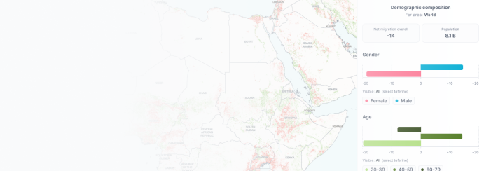
Explore the dashboard
Overview
We have developed a spatial general equilibrium model of the world economy that integrates state-of-the-art macroeconomic modelling with the impacts of climate change. Its key features include detailed spatial resolution for modelling (up to 5x5 km pixels) and joint interactions between labour markets, production processes, international trade and consumption decisions influenced by price and income levels. Climate damage affects economic perspectives and thus alters migration patterns at international and internal scales.
The model, calibrated with 2010 data, simulates economic dynamics for 2030-2090.
Model mechanisms & framework
Our theoretical framework encompasses various modules interacting through key mechanisms:
1. Firms operate across agricultural, industrial and service sectors, optimizing input combinations.
2. Individuals across age, gender and education groups consume sector-specific domestic and imported goods, subject to evolving preferences and price levels.
3. Climate damage impacts labour productivity, crop yields and local amenities through changes in temperature levels, sea-level rise and expected losses due to disasters.
4. Migration decisions adapt to economic shifts and climate-induced changes, subject to individual-type-specific dyadic costs of moving at various distances.
5. Demographic Demographic dynamics account for fertility, mortality and education, determining future population structures aligned with IPCC’s SSPs.
Our comprehensive model provides insights into the complex interactions between economic decisions, climate change and migration dynamics. By capturing the nuanced behaviours of individuals and firms within a changing climate, it offers valuable perspectives for understanding and addressing future challenges. By compiling and processing diverse datasets, we lay the groundwork for a robust simulation model capable of capturing the complex interplay between economic, demographic and environmental factors.
You can test this mechanism yourself
Dive into the dashboard directly and start interacting with our model. You can come back here later!
Explore the dashboard
Data Compilation for Model Calibration
Population
Using data from Bondarenko et al. (2020) and WorldPop (2019), we generate 5x5km rasters of global population counts (constrained UN adjusted individual countries aggregated from the 0.1km resolution) for 2020, from which we impute the 2010 using the 2010 and 2020 global population counts (unconstrained global mosaics aggregated from the 1km resolution). Note that all the population rasters are available at WorldPop.org at 5-year groups and by gender. Overall, we produce rasters of populations by age and gender groups: A1G0, A2G0, A2G0, A4G0, A1G1, A2G1, A3G1, A4G1 groups, where A1, A2, A3, A4 refer to age groups 0-19, 20-39, 40-59, and 60-79 year old, while G0 and G1 represents men and women, respectively.
Get data
Gross Domestic Product
We compute the total GDP produced in each admin unit in 2010 using the 1x1km raster of GDP values provided by Kummu et al. (2018) for 2010. The numbers, aggregated at the country level, are then adjusted to sum up to the 2010 data published in the WDI database by the World Bank.
Get data
Urbanization
We utilize high-resolution global data on built-settlement growth from WorldPop.org (Nieves et al., 2020; WorldPop, 2018), which is reshaped to 5km resolution to calculate pixel-level urbanization rates. It combines census-based sectoral employment shares from 1,400 administrative units with national-level employment and GDP data from the World Bank to estimate sector-specific employment and GDP for each admin unit, imputing missing values using regression models. These estimates are adjusted to align with national sectoral totals, accounting for working-age population distribution. The final step involves spatial downscaling, assigning each pixel within an admin unit to agriculture, industry, or services based on its urbanization rate and the admin unit's employment structure, using thresholds derived from the cumulative distribution of the working-age population sorted by urbanization.
Get data
Education Shares
The model requires education attainment data at three spatial levels: national, administrative unit, and pixel. First, country-specific education distributions for 2010 are derived using Barro-Lee data (Barro and Lee, 2013), disaggregated by age, gender, and education levels, with missing countries estimated via regressions on GDP per capita. Then, administrative-unit-level education shares by economic sector are obtained using microdata from IPUMS, LFS, censuses, and ILO, covering 96 countries directly and imputing the rest through regression or neighbor-based transposition. These estimates are adjusted to match national aggregates through an iterative balancing procedure. Finally, pixel-level education distributions are estimated using urbanization maps and sectoral employment rasters, assuming sector-specific education distributions and urbanization-weighted blends between sectors. A final iterative algorithm ensures that pixel-level education rates align with admin-unit-level totals across all demographic and sectoral groups.
Get data
Agriculture Productivity
The model incorporates climate-induced changes in land productivity using pixel-level data from the FAO's GAEZ database (FAO and IIASA, 2022), which includes crop yields, irrigation rates, and production volumes for 14 major crops in 2010 and under future climate scenarios. By combining these data with global average crop prices, the model calculates each pixel's crop production value share in 2010, assuming these shares remain constant over time and excluding crop switching behavior. Yield changes under various climate scenarios are weighted by crop intensity and aggregated into a single land productivity indicator, which is then spatially smoothed using a 50km radius.
Get data
Total Factor Productivity
To compute total factor productivity (TFP) at the pixel level, the model integrates data on employment, sectoral structure, climate damages, and GDP, using fixed technological parameters and wage data from the ILO. Wages by skill level and sector are imputed and regressed on GDP per capita to estimate relative skill productivities across countries, which feed into a binary search algorithm that calibrates admin-unit-level TFP residuals to match observed GDP data. Pixel-level TFP values are then computed using these residuals and adjusted for land and labor productivity damages, skill spillovers, and climate impacts, ultimately allowing for the calculation of pixel-specific wages across all sectors and skill levels based on model equations.
Get data
Utility Levels
Wage and price data are combined with estimated elasticities to compute pixel-specific utility levels for all individual types worldwide. Key elasticities—such as those linking wages to migration decisions and congestion to utility—are estimated using international migrant flow data and gravity variables, along with regressions on population change and density. With parameters like wage elasticity (from migration gravity regressions) and congestion elasticity, utilities are computed using deterministic utility equations that incorporate wages, population density, and land productivity, and are then aggregated to the admin-unit and country levels using a log-sum approach.
Get data
Sea Level Rise Damages
To compute damages from sea level rise (SLR), the model combines global elevation data from NASA with probabilistic SLR and storm surge projections from Tebaldi et al. (2021) and Kirezci et al. (2020). SLR projections are spatially interpolated and applied to a pixelized world map, and an iterative algorithm determines flooding by simulating water spread from coastal pixels inward based on elevation. The result is a series of global flood maps at 1x1 km resolution, later aggregated to 5x5 km grids, for all future time points and climate scenarios.
Temperature Damages
To assess how rising temperatures affect labor productivity, the study combines climate projections from WorldClim (averaging 22 CMIP6 models from CMIP6: Eyring et al. (2016) Petrie et al. (2021)) with sector-specific damage functions provided by the ILO (Kjellstrom et al., 2018). For each time period and scenario—particularly RCP7.0—pixel-level climate variables (e.g., mean and extreme temperatures) are used to fit skew-t-student distributions that capture the annual temperature profile. These temperature distributions are then multiplied by sector-specific damage functions and integrated to estimate productivity losses in each pixel; this process is repeated globally, resulting in detailed spatial maps of labor damages that vary by sector, time, and climate scenario.
Get data
Disasters
The model quantifies the global impact of four types of disasters—droughts, floods, heatwaves, and cyclones—by estimating their effects on the expected utility of each 5 km pixel. Drought damages are based on projected SPEI values (Vicente-Serrano et al., 2010) computed from historical and CMIP6 climate data (Fick and Hijmans, 2017), with losses increasing as SPEI drops below -1. Flood risks are modeled by combining historical flood maps with shifts in SPEI-derived probabilities, adjusting expected damages accordingly using (Dottori et al., 2016). Heatwave damages are calculated from changes in temperature extremes using fitted distributions, while cyclone impacts are derived from simulated storm tracks and wind speeds (Lee et al., 2020, and Meiler et al., 2022, respectively), matched with World Bank loss functions to estimate GDP-related damage per pixel across time and climate scenarios.
References
1.
Barro, R. J. and Lee, J. W. (2013).
A new data set of educational attainment in the world, 1950–2010. Journal of Development Economics, 104:184–198.
2.
Bondarenko, M., Kerr, D., Sorichetta, A., and Tatem, A. (2020).
Estimates of 2020 total number of people per grid square, adjusted to match the corresponding UNPD 2020 estimates and broken down by gender and age groupings, produced using built-settlement growth model (BSGM) outputs. WorldPop.
3.
Dottori, F., Salamon, P., Bianchi, A., Alfieri, L., Hirpa, F. A., and Feyen, L. (2016).
Development and evaluation of a framework for global flood hazard mapping. Advances in Water Resources, 94:87–102.
4.
Eyring, V., Bony, S., Meehl, G. A., Senior, C. A., Stevens, B., Stouffer, R. J., and Taylor, K. E. (2016).
Overview of the Coupled Model Intercomparison Project Phase 6 (CMIP6) experimental design and organization. Geoscientific Model Development, 9(5):1937–1958.
5.
FAO and IIASA (2022).
Global Agro-Ecological Zones Version 4 (GAEZ v4).
6.
Fick, S. E. and Hijmans, R. J. (2017).
WorldClim 2: new 1-km spatial resolution climate surfaces for global land areas. International Journal of Climatology, 37(12):4302–4315.
7.
Lee, C.-Y., Camargo, S. J., Sobel, A. H., and Tippett, M. K. (2020).
Statistical–dynamical downscaling projections of tropical cyclone activity in a warming climate: Two diverging genesis scenarios. Journal of Climate, 33(11):4815–4834.
8.
Kirezci, E., Young, I. R., Ranasinghe, R., Muis, S., Nicholls, R. J., Lincke, D., and Hinkel, J. (2020).
Projections of global-scale extreme sea levels and resulting episodic coastal flooding over the 21st century. Scientific Reports, 10(1):1–12.
9.
Kjellstrom, T., Freyberg, C., Lemke, B., Otto, M., and Briggs, D. (2018).
Estimating population heat exposure and impacts on working people in conjunction with climate change. International Journal of Biometeorology, 62(3):291–306.
10.
Kummu, M., Taka, M., and Guillaume, J. H. (2018).
Gridded global datasets for gross domestic product and human development index over 1990–2015. Scientific Data, 5(1):1–15.
11.
Meiler, S., Vogt, T., Bloemendaal, N., Ciullo, A., Lee, C.-Y., Camargo, S. J., Emanuel, K., and Bresch, D. N. (2022).
Intercomparison of regional loss estimates from global synthetic tropical cyclone models. Nature Communications, 13(1):6156.
12.
Nieves, J. J., Sorichetta, A., Linard, C., Bondarenko, M., Steele, J. E., Stevens, F. R., Gaughan, A. E., Carioli, A., Clarke, D. J., Esch, T., et al. (2020).
Annually modelling built-settlements between remotely-sensed observations using relative changes in subnational populations and lights at night. Computers, Environment and Urban Systems, 80(101444).
13.
Petrie, R., Denvil, S., Ames, S., Levavasseur, G., Fiore, S., Allen, C., Antonio, F., Berger, K., Bretonnière, P.-A., Cinquini, L., et al. (2021).
Coordinating an operational data distribution network for CMIP6 data. Geoscientific Model Development, 14(1):629–644.
14.
Tebaldi, C., Ranasinghe, R., Vousdoukas, M., Rasmussen, D., Vega-Westhoff, B., Kirezci, E., Kopp, R. E., Sriver, R., and Mentaschi, L. (2021).
Extreme sea levels at different global warming levels. Nature Climate Change, 11(9):746–751.
15.
Vicente-Serrano, S. M., Beguería, S., and López-Moreno, J. I. (2010).
A multiscalar drought index sensitive to global warming: the standardized precipitation evapotranspiration index. Journal of Climate, 23(7):1696–1718.
16.
WorldPop (2018).
WorldPop (www.worldpop.org - School of Geography and Environmental Science, University of Southampton; Department of Geography and Geosciences, University of Louisville; Département de Géographie, Université de Namur) and Center for International Earth Science Information Network (CIESIN), Columbia University (2018). Global high resolution population denominators project - funded by the Bill and Melinda Gates Foundation (OPP1134076). https://dx.doi.org/10.5258/SOTON/WP00649.
17.
WorldPop (2019).
WorldPop (www.worldpop.org - School of Geography and Environmental Science, University of Southampton; Department of Geography and Geosciences, University of Louisville; Département de Géographie, Université de Namur) and Center for International Earth Science Information Network (CIESIN), Columbia University (2018). Global high resolution population denominators project - funded by the Bill and Melinda Gates Foundation (OPP1134076). https://dx.doi.org/10.5258/SOTON/WP00646.
Learn more
More topics from our Knowledge Base for further reading
Understanding the Spatial General Equilibrium Model
Gain comprehensive insights into the complex spatial general equilibrium model used to project significant climate change impacts on migration and the global economy.
How to navigate the Climate Migration Dashboard
Learn how to effectively use the Climate Migration Dashboard, including tips on accessing data, using visualization tools and customizing reports for your needs.
Our partners


Contact LISER
Luxembourg Institute of Socio-Economic
Research (LISER)
Maison des Sciences Humaines
11, Porte des Sciences
L-4366 Esch-sur-Alzette / Belval
E-mail: clicme@liser.lu
Tél.: (+352) 58 58 55 – 1
Technical problems?
The results published on this website by LISER have been generated using information, techniques, data, databases, algorithms, methodology, models, results, design, technology, material, inventions and/or software and any intellectual property rights (LISER’s background) as well as publicly available data, facts and information as detailed in our Knowledge Base. For the avoidance of doubt, LISER remains the sole owner of all LISER’s material, work, results and background.
The results of the project published by LISER on this website for dissemination of the knowledge, research and/or teaching purposes, may be accessed and used freely on an ‘AS IS’ basis, without any representation or warranty of any kind by LISER, either express or implied, including but not limited to any warranty or conditions of merchantability or fitness for any particular purpose.